
GEOCATMIN, CADASTRAL GEOLOGICAL AND MINING SYSTEM. INGEMMET - PERU.
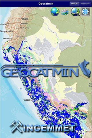
Geocatmin, is the mining geological and cadastral information system, developed by Ingemmet, with the latest GIS technology, in order to facilitate users of georeferenced information; Contributing to the promotion of mining investment, disaster prevention, territorial planning and sustainable development of Peru.
That can be done.
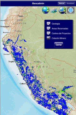
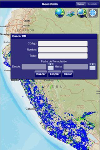
• Find access to information from the national mining cadastre
• Graph mining rights
• Consult areas restricted to mining activity.
• Interact Google Earth's base maps.
• Obtain coordinates, calculate areas and distances.
 Download(1.68MB)