
Map application for off-road activities
Features;
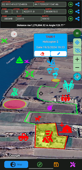
- Map for off-road activities
- Multiple coordinate types(UTM, MGRS, LAT LONG)
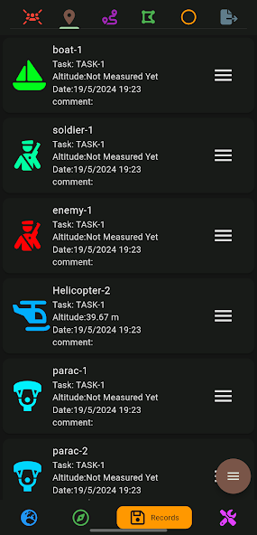
- Operation/Activity planning
- Sharing scheduled recordings
- Export scheduled recordings
- Import scheduled recordings
- Compass feature
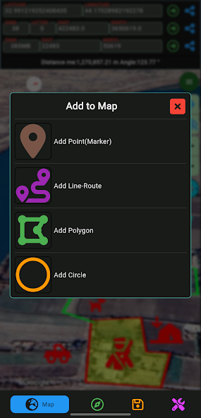
- Adding a marker to the map (with color, image and size options)
- Designing Lines/Routes
- Design areas (with frame and fill color options)
- Design circles (with frame and fill color options)
- Automatic route recording creation
- Progress at the specified distance at the specified angle
-Live location tracking
 Download(89.53MB)